







Explore
Whether you're aching to set your eyes on ancient pottery, walk under sweet smelling pines in the Gila, or take a glorious scenic drive - there's something for you. It's time to make some memories!


Photos courtesy of Casitas de Gila
Birding in the Silver City, New Mexico Area
Discover One of the Southwest's Premier Birding Destinations
Whether you're identifying your first Vermilion Flycatcher or adding sought-after species to a life list, the Silver City area in southwestern New Mexico, offers some of the most rewarding birding in the American Southwest.
Located where the Rocky Mountains, Chihuahuan Desert, and diverse riparian ecosystems meet, Grant County is home to an extraordinary variety of habitats and birdlife. More than 300 species have been recorded in the region, making it one of New Mexico's premier birding destinations. The area's remarkable diversity is driven by dramatic elevation changes—from desert valleys below 4,000 feet to forested mountain peaks above 10,000 feet—as well as rivers, streams, grasslands, woodlands, and wilderness areas.
The result? An exceptional birding experience where a single day can take you from cottonwood-lined river corridors alive with warblers and flycatchers to cool mountain forests inhabited by woodpeckers, nuthatches, and high-elevation species.
 Why Birders Love the Silver City Area
Birders from around the United States visit southwestern New Mexico for one simple reason: habitat diversity.
Within a relatively short drive of Silver City, you'll find:
- Riparian forests along rivers and streams
- Desert grasslands and scrublands
- Juniper and oak woodlands
- Ponderosa pine forests
- Mixed conifer mountain habitats
- Wetlands, ponds, and lakes
These varied ecosystems attract year-round resident birds as well as migrants traveling along important North American flyways. Spring and fall migrations can be especially exciting, with new arrivals appearing almost daily.
Birding for Beginners
One of the best things about birding in the Silver City area is that you don't need to be an expert.
Many visitors are surprised by how quickly they begin spotting colorful and charismatic species. A short walk near water, a quiet morning in a city park, or a scenic drive through the countryside can produce memorable sightings.
Common species frequently encountered in the region include:
- Vermilion Flycatchers
- Northern Cardinals
- Gila Woodpeckers
- Black Phoebes
- Roadrunners
- Various hummingbirds
- Towhees and thrashers
- Hawks and raptors
Bring a pair of binoculars, move slowly, and take time to listen. Birds often reveal themselves by sound before they are seen.
 Challenges for Experienced Birders
More experienced birders quickly discover why southwestern New Mexico enjoys a strong reputation among serious birding enthusiasts.
The region's unique blend of mountain and desert habitats creates opportunities to observe species that are uncommon or difficult to find elsewhere. Depending on the season and location, birders may encounter:
- Montezuma Quail
- Common Black-Hawk
- Bell's Vireo
- Lucy's Warbler
- Olive Warbler
- Phainopepla
- Elf Owl
- Various tanagers and migratory warblers
Migration periods can be especially productive, with birders often recording impressive species counts during a single visit.

Top Birding Habitats Around Silver City
The Gila River Corridor
Northwest of Silver City, the Gila River and its cottonwood-willow bosque create one of the region's richest birding environments. This lush riparian habitat attracts an impressive variety of resident and migratory species and is particularly rewarding during spring migration. More than 200 bird species have been documented in parts of the Gila River ecosystem.
Gila National Forest & Gila Wilderness
The vast Gila National Forest and Gila Wilderness encompass everything from desert foothills to high-elevation conifer forests. Birders can explore a wide range of habitats while enjoying some of the most spectacular scenery in New Mexico. The forest's diversity supports hundreds of bird species and offers excellent opportunities for both casual birdwatching and serious birding expeditions.
Mimbres Valley
The Mimbres River watershed provides another outstanding birding environment. Cottonwood-lined waterways, marshy areas, grasslands, and surrounding mountain slopes create a rich mosaic of habitats that support a remarkable variety of wildlife and birds.
Grasslands and Desert Landscapes
The open spaces surrounding Silver City offer excellent opportunities to observe meadowlarks, raptors, sparrows, and other species adapted to grassland and desert environments. These habitats provide a striking contrast to the region's river corridors and mountain forests.

Birding Through the Seasons
Spring
Spring migration begins in late April and brings an influx of colorful migrants. Many birders consider this one of the best times to visit.
Summer
Summer is prime season for breeding birds, hummingbirds, and nesting activity. Early mornings can be especially productive.
Fall
Fall migration offers another chance to see a wide variety of species moving through the region.
Winter
Many resident species remain active throughout winter, and the mild climate often allows for comfortable birding when other parts of the country are snowbound.
Tips for a Great Birding Experience
- Start early when birds are most active.
- Carry binoculars and a field guide or birding app.
- Bring plenty of water, especially during warmer months.
- Dress in layers, as temperatures can vary significantly with elevation.
- Respect wildlife and observe birds from a distance.
- Keep a checklist—you may be surprised how quickly your species count grows.
Resources


A guide to the best bicycling around Silver City and Grant County
By Jackie Blurton
Sponsored by Silver City KOA Kampground, 11824 Hwy 180 E., Silver City. NM 88061, (575) 388-3351, frontdesk@silvercitykoa.com
Silver City and Grant County are getting a reputation as a great destination for year-round bicycling. Silver City is located along the Continental Divide in the foothills of the Gila National Forest. The winter months cooperate with stretches of great weather and bountiful sunshine. Summer months have consistently good weather and moderate temperatures offering incredible riding in the mountains as well at lower elevations. Altitudes for our trails and roads range from about 6,000 to over 8,000 feet.
This guide is your introduction to some of our favorite mountain and road rides. More information, mountain bike trail maps, bike gear, sales, and service are available at:
- Gila Hike & Bike 103 College St, Silver City, NM 88061, 575-388-2223
- Twin Sisters Cycling & Fitness 208 W. Broadway, Silver City, NM 88061, 575-538-3388
- Silver City Cycles/The Bike Works 914 W. Pope St. Silver City, NM 88061, 575-388-1444
Information and mountain bike trail maps are also available at:
- Gila National Forest Supervisors Office 3005 E Camino del Bosque, Silver City, NM 88061, 575-388-8201
Mountain Bike Rides
A. Boston Hill: This large city park in the hills overlooking Silver City has great trails and easy access from town. The trails loop around the mines giving riders interesting views into the digs. Stay on the trails, and use caution when near the digs. The rides are moderate with some steep slopes. Map available.
Directions to trailhead: The best trailheads are the Market Street Trailhead at the junction of Hwy 180 W and Market Street on the west side of town and Cooper Street Trailhead on South Cooper
B. Burro CDT South, south of Silver City: This is a new segment of the Continental Divide Trail in the Gila National Forest. It winds through rolling high-desert hills. A mile from the trailhead is a one-mile section of old mining roads and the route is confusing. Look for cairns, and trail markers, and follow forest roads 4050Q and 4090Q which take you around the hill, not away from the hill. These will become single track again. It's about 8 miles from the trailhead to where it intersects NM 90. It's a moderate to difficult trail. Map available.
Directions to trailhead: South from Silver City on NM 90 between mile markers 22 & 21. Turn right after the Continental Divide Trail sign onto Forest Road 282. The road becomes a loop drive and going either direction will take you to the parking area. Park near the trailhead sign for Jacks Peak. Across the grassy clearing to the south is a large cairn and CDT marker that mark the trailhead.
C. Separ Road south of Silver City: This road is the designated Great Divide road route that parallels the CDT and is an easy ride for beginners.
There's no destination as a turnaround point so keep track of your mileage and don't ride further than you want to ride back.
Directions to Separ Road: South from Silver City on NM 90. There is a street sign on the left at mile marker 25. Park on pull-offs along the road.
D. Continental Divide Trail north of Silver City: The CDT crosses Forest Road 506 in the Gila National Forest north of Silver City. From this trailhead, you can go either south or north. Going south will link up with the Gomez Peak trails described below. Going north the trail ascends into higher mountains and is rocky and technical. This north segment comes out where the CDT crosses NM 15 north of Pinos Altos.
Directions to trailhead: Go north from Silver City on Little Walnut Road about 5 miles past the Little Walnut Picnic area and then about 3 miles further on Forest Road 506 to the trailhead.
E. Little Walnut Picnic Area/Gomez Peak Trail System: There is a great system of trails that begins at the Gomez Peak Parking Lot or Little Walnut Picnic Area in the Gila National Forest. These moderate to difficult trails are loops that circumvent several peaks and link up with the CDT. Map available.
Directions to trailhead: Go north from Silver City on Little Walnut Road about 5 miles to the Gomez Peak Parking Lot or Little Walnut Picnic area.
F. Fort Bayard Wildlife Refuge: This is part of the Gila National Forest and has a great system of National Recreation Trails. The trails in the foothills are smoother and fast. As you get closer to the mountains they're rockier and more technical.
Directions to trailhead: There are two trailheads. For the first one go east from Silver City on Hwy 180 and between mile marker 118 and 119 turn left onto the Old Arenas Valley Road, then go 1 mile to the parking area. For the second trailhead continue east to the stop light between mile markers 121 and 122 and turn left into Ft. Bayard. When you enter Ft. Bayard bear to the right at the "Y" intersection and follow the signs for Forest Road 536. When the road becomes dirt it is about 3 miles to the trailhead parking area.
G. Signal Peak: This is the location of the Signal Peak Challenge Mountain Bike Race. This mountainous pine and aspen forested county has moderate to difficult trails and forest roads. Best for riding in the summer and fall. Map available.
Directions to trailhead: Go north from Silver City on NM 15. Between mile markers 15 and 16, there is a graded gravel road on the right and plenty of room to park. From here you can follow the road or the single tracks both of which will link to other roads and trails.
Road Bike Rides
Lightly traveled roads and good pavement make Silver City and Grant County a great place for road bikes. The Tour of the Gila, an annual 5-day, pro road race takes place in April. Our area is a winter training destination for pro teams and a great year-round destination for fitness and recreational cyclists. In this guide mileages are approximate and ride numbers are keyed to the map on the other side. There are no maps specifically for these rides. You can get an area map from the Silver City-Grant County Chamber of Commerce or use a New Mexico highway map.
1. US 180 West (NM Bike Route 18): A light to moderately traveled road with shoulders. After a couple miles ascent from Silver City to the Continental Divide there's a 9-mile descent to Mangas Valley. The terrain then becomes valleys and small hills with open country and scenic mountain vistas. You can continue on 180 as far as you want or you can do a loop (1A) through the towns of Cliff and Gila and back to Silver City which will give you about 60 miles.
Directions: Go west from Silver City on 180.
2. NM 90: A light to moderately traveled road with shoulders. The road has some long moderate grades and rolling hills up to the Continental Divide between mile markers 22 and 21, about 22 miles from Silver City. After the Divide, the hills descend into the low desert to the town of Lords-burg 44 miles from Silver City.
Directions: Go south from Silver City on 90.
3. NM 15 to Sapillo Creek: This is a local favorite. Traffic is light with moderate traffic on the weekends. From Silver City to Pinos Altos, about 7 miles, the road is 2-lane with shoulders. North of Pinos Altos the road becomes a narrow 2-way with no lane markings or shoulders. It winds through the ponderosa pine forest with many blind curves so you need to stay in your lane and look out for oncoming traffic. It's 18 miles from Pinos Altos to the junction with NM 35. There are several good turn-around points if you don't want to go all the way. The last 3-mile descent into Sapillo Creek is steep with blind hairpin curves.
Directions: Go north from Silver City on 15.
3a. NM 15 to the Gila Cliff Dwellings: From the junction of NM 15 & 35, it's about 19 miles to the Gila Cliff Dwellings. This section of NM 15 is a well-paved 2-lane with continuous curves and long, steep climbs. It's about a 6-mile climb to the Clinton P. Anderson Vista after which the road descends steeply for about 9 miles to the Gila River Valley.
It's 4 miles further to the end of the road and the Cliff Dwellings. The climb back out is tough, especially on a summer afternoon. This is a ride for experienced riders and a great training ride for racers.
Directions: Go north from Silver City on 15.
4. NM 152 to the Mimbres River Valley: This ride takes you east of Silver City into the Mimbres River Valley. Hwy 180 East leaving Silver City is a busy 4-lane with shoulders that junctions with NM 152 five miles east of town. 152 is a lightly traveled 2-lane with shoulders. This road has many climbs and goes past a vista where you can view the Chino Copper Mine. A couple miles past the mine the road descends into the Mimbres River Valley. In the valley, about 20 miles from Silver City, NM 152 junctions with NM 35 between mile marker 14 and 15. This is a good turn-around point.
Directions: Go east from Silver City on Hwy 180 then turn left onto NM 152 at the junction between mile markers 121 and 122.
Ride options in the Mimbres River Valley: In the Mimbres River Valley you have three options:
Note: If you don't want to ride to the Mimbres River Valley from town you can drive out and park in the gravel parking area at the junction of NM 152 and 61 at mile marker 15 and ride from there.
4a. Emory Pass: NM 152 continues across the valley and then climbs 17 miles into the Black Range to 8,000 ft. Emory Pass. This great mountain climb takes you into pine and aspen forests and is for experienced riders. The first 6 miles of the ascent is a wide 2-lane with shoulders but after the National Forest boundary becomes a narrow 2-lane with blind curves and some steep climbs. Traffic is light.
Directions: Continue east across the Mimbres River Valley on NM 152.
4b. Mimbres River Valley north on NM 35: NM 35 is an easy ride up the valley along the Mimbres River to the Continental Divide between mile markers 15 and 16. It's a short hill climb up to the Divide. On the west side of the Divide is a short descent into the Sapillo Creek valley. The next 8 miles to Lake Roberts is a beautiful, easy ride through meadows and stands of ponderosa pine.
There are some short, steep climbs around Lake Roberts. River Vista, a picnic area overlooking the lake, has a toilet. A half mile further is the Lake Roberts store. About 3 miles further is the junction of NM 35 and NM 15. The road is a narrow 2-lane with light traffic.
Directions: From the junction of NM 152 and NM 35 go north on 35 up the Mimbres River Valley.
4c. Mimbres River Valley south on NM 61: NM 61 is an easy ride that follows the lower Mimbres River Valley through high-desert hills. There isn't a turn-around destination so go as far as you want. It's about 26 miles to the junction with Hwy 180. If you want to make a big loop you can continue down NM 61 and return to Silver City on Hwy 180. It's about a 75-mile loop. NM 61 is a narrow 2-lane with a course asphalt surface and light traffic. Hwy 180 is a heavy traffic two-lane with shoulders.
Directions: From the junction of NM 152 and NM 61 go south on 61 down the river valley.
5. Trail of the Mountain Spirits National Scenic Byway: NM 15, 35, 152 and Hwy 180 connect to form the 74-mile loop through the mountains of the Gila National Forest. The roads have been described in 3 and 4 above.
Directions: From Silver City, you can do this loop by going north on NM 15 or east on Hwy 180 and linking up with NM 152 and 35.
Copyright 2015 by Jackie Blurton. No part of this guide may be reprinted or used without the written permission of the author. The author bears no responsibility for accidents, injuries, or loss from any cause for anyone using this guide.


The drive from Silver City to the Catwalk is a scenic trip. Highway 180 curves and rolls along the foothills of the Mogollon Mountains, a sky bound fortress of peaks cut by deep, craggy canyons. Whitewater Canyon is one of them.
In the village of Glenwood you turn off the highway and five miles up the valley the road ends where the Catwalk narrows begin. There’s a beautiful National Forest picnic area shaded by giant Sycamore trees along the banks of Whitewater Creek and educational signage about the history and geology. The first section of the Catwalk National Recreation Area through the narrows is universal and can accommodate people of varying abilities.
The Catwalk National Recreation Area is a passage to hidden, secret places. Sheer cliff walls rise out of the streambed and the walkways, that are supported on steel beams 20 feet above the stream, and zigzag from cliff to cliff as they wind through the canyon.
From the bridge the trail continues up Whitewater Canyon. It’s worth going about 100 feet further to an overlook above the bridge to get a view of the canyon. If you want to hike further continue on up the canyon and you’ll be rewarded by the beauty of Whitewater Creek and spectacular rock formations.
The Catwalk National Recreation Area is a relaxing and rewarding way to spend the day enjoying a natural wonder and making memories. Take lots of pictures.


A Rocky Vacation
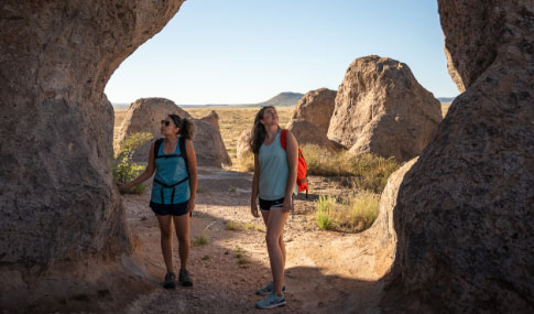
Formed of volcanic ash welded together 35 million years ago, then sculpted by wind and water into rows of monolithic blocks, these incredible rock formations give City of Rocks its name. Hiking trails, a botanical garden and a public night sky observatory add to this unique destination.A Rocky Vacation: Rock formations like those at the City of Rocks State Park exist in only six other places in the world. Imaginative visitors may see the rock formations as a small city with houses, chimneys, courtyards and streets. Visitors can choose from 62 campsites scattered among the rocks, from which they can hike, bird watch, picnic, bike, take in the interpretive exhibits at the visitor center, explore the park’s botanical garden or star gaze.
Life on the Rocks: City of Rocks State Park lies in the Mimbres Valley of the Chihuahuan desert. The park and surrounding grassland support yucca, agave, cacti and ocotillo, while growing among the rocks are Emory and gray oak. Mule deer, roadrunners, javelinas, cactus wrens, western diamondback rattlesnakes, ground squirrels, coyotes and jackrabbits all make their home here.
History on the Rocks: Until 1200 A.D., Mimbres Indians roamed this area, leaving arrowheads and pottery shards as evidence of their culture. The park also lies within the traditional homelands of the Chiricahua and Warm Springs Apache. Spanish explorers and settlers arrived in 1500 and mule trains loaded with copper from the nearby Santa Rita mine passed nearby on their way to Chihuahua from 1804 to 1834. After the Mexican War of 1846-48, the Mormon Battalion blazed a trail south of the park to link newly acquired New Mexico and Arizona with the eastern United States.
First Astronomical Observatory: Southern New Mexico is famous for its clear night skies and New Mexico State Parks established its first astronomical observatory at City of Rocks State Park. The observatory is a 12’ x 16’ building with a roll-off roof and is equipped with a 14″ Meade LX-200 telescope. The entire facility is solar-powered and includes a 20-inch monitor, which enables visitors to view images of the planets, stars and constellations transmitted through the telescope.
Getting There: To get to City of Rocks State Park from Deming, take US 180 northwest 24 miles; then go northeast on NM 61 for 4 miles to the park entrance road. Includes: 52 sites‚ 10 w/ electric‚ restrooms‚ showers.
NM 61 (4 mi. NE of US 180)
Faywood, NM
575-536-2800


Silver City is the first Gateway Community along the Continental Divide Trail, which recently celebrated its 10th anniversary with this designation. The Town of Silver City partners with the Continental Divide Trail Coalition to host its annual Trail Days every spring.
The Continental Divide Trail (CDT), a national scenic trail, is known for the more than 3000 miles it covers from Montana’s Canadian border to Old West Country’s New Mexico border with Mexico. You’ll have the opportunity to hike about 350 miles from north of Pie Town (west of Socorro in the Cibola Mountains) to the Mexico border near the international port of entry at Antelope Wells, where the trail crosses the grayish limestone outcrops of the Big Hatchet Mountains.
In Old West Country, the Continental Divide Trail tries to follow the actual Continental Divide. But here and there it will divert to bypass private land or to follow a more accessible trail. It passes through the rugged, forested mountains of the Gila National Forest, and one of our country’s most spectacular Wilderness Areas, the Aldo Leopold, the first area designated as wilderness by Congress.
One of the highest peaks on the Trail is Pelona Peak at 9,220 feet. Through the Gila National Forest and the Apache National Forest some of the landmarks traversed are Elk Mountain, John Kerr Peak, Coyote Peak, and Wahoo Canyon in the Black Range.
Silver City and Pinos Altos straddle the Continental Divide at 6000-7500 feet, providing surprisingly cool summers in the Southwest, as well as uninterrupted views of the Mexican border to the south. The Divide follows that ridge from which water flows either west to the Pacific or east to the Atlantic. You will cross the Divide many times as you travel through the Trail of the Mountain Spirits Scenic Byway in Old West Country.

Click Map to enlarge
Dangerous Dan Tucker (dangerousdantucker.com) was the first Marshal of Silver City appointed in 1878. Learn about his storied past at the exhibit at The Ice Cream Emporium on Bullard Street. According to the book, Dangerous Dan Tucker, written by Bob Alexander, "After the McClaurey brothers and young Billy Clanton were gunned down near Tombstone's Fremont, the feud between the Earps and the "cowboys" and the competing newspaper journalists began in earnest. Common sense would recognize that if Wyatt Earp (or anyone else) was "inviting a confrontation" he could have had one at any time or place of his choosing. For his own reasoning, Wyatt Earp chose to flee rather than to fight or take his chances with due process by submitting to lawful arrest. To avoid this arrest, Earp and his entourage traveled to Silver City on horseback to eventually reach Colorado. One author concludes, that the bunch avoided a much quicker and more direct route through Deming because they feared arrest from Dan Tucker. Earp and Doc Holliday both avoided Silver City because of Dangerous Dan Tucker with a reputation of intimidating prowess. Dangerous Dan Tucker was not only the first appointed marshal, he was a fierce gunslinger and a reputable lawman."
Although little known today, Tucker is considered by some historians to have been one of the most dangerous, albeit underestimated, gunmen in the history of the Old West. Alexander proclaimed Tucker more dangerous and more effective than better known lawmen, including Wild Bill Hickock and Wyatt Earp. He was supported in this claim by historian Leon C. Metz. He was also a subject in the book Deadly Dozen, by author Robert K. DeArment, who included Tucker as one of the twelve most underrated gunmen of the Old West.


Fort Bayard played an integral role in protecting settlers and miners in the Los Pinos and Silver City mining districts. Copper, silver, and gold mining spurred economic development of this region of southwestern New Mexico. Soldiers from the fort battled many of the most famous Apache war leaders, including Victorio, Nana, and Geronimo.
The first all-black regular army units made up of enlisted personnel, referred to as Buffalo soldiers, were organized in 1866 in the close of the Civil War. Fort Bayard was home to hundreds of Buffalo soldiers, who fought Apaches with distinction and who participated in the chase for Geronimo. His capture by Brig. Gen. Nelson A. Miles in 1886 effectively ended the Apache wars.
An unusual sequence of events has helped preserve the integrity of Fort Bayard. The post buildings were transferred to the Surgeon General of the Army, then the Veteran’s Administration, and finally to the State of New Mexico as a hospital. Its layout and many of the buildings date to the late 19th century and offer the visitor a rare opportunity to see a military fort as it would have appeared in the 1800’s.
Today, the fort maintains many historic buildings and monuments, including the life-sized monument to the Buffalo Soldiers stationed here. Take a self-guided tour year round, or a guided tour on Saturdays during the Spring to Fall months. Fort Bayard also hosts an annual historic re-enactment of fort life in the 1800’s during the annual Fort Bayard Days.


The Gila Cliff Dwellings National Monument offers a glimpse of the homes and lives of the people of the Mogollon culture who lived there from the 1280’s through the early 1300’s. Containing 533 acres, the monument was established on November 16, 1907. The dwellings are located forty-four miles north of Silver City, New Mexico, on Highway 15.
Surrounded by the Gila National Forest, the Gila Cliff Dwellings National Monument lies at the edge of the Gila Wilderness, the nation’s first designated wilderness area. This unique area in southwestern New Mexico offers a glimpse of the homes and lives of Indians who lived here from the 100’s to 1300.
Settlers in the early 1870’s penetrated the area in search of water and fertile land on which to homestead. They were surprised to find traces of an earlier race of men, who in the dim past had lived, loved and farmed the narrow valleys. Fallen walls of stone, strewn with pottery fragments, clearly indicated a people of high culture who made their homes there.
The cliff dwellings were built in the 1280’s. These Pueblo people built their homes in natural caves and in the open. There are examples of both types of settlements in the monument area. Probably not more than 8 or 10 families lived in the cliff dwellings at any one time. The rooms were probably not used for more than one generation.
These small, diligent, artistic people lived in cliff houses and riverside villages, tilling mesa top and riverside fields with digging sticks, grinding cornmeal with metates and manos, fashioning pottery and cloth, carrying on trade with Indians of other communities, hunting, and gathering wild plants and fruit to supplement their squash, corn, and beans. They were skilled potters, producing handsome brown bowls with black interiors and black-on-white vessels.
Seven natural caves occur high in the southeast-facing cliff on a side canyon, and five of the caves contain the ruins of cliff dwellings– 42 rooms. Walls of the buildings were constructed of stone. All the timbers seen in the dwellings are the originals. Tree-ring dates obtained from these timbers range through the 1280’s. The cliff dwellers had abandoned their homes and fields by 1300. Why they left and where they went are not known. Perhaps they joined other Pueblo Indians to the north or south.
Climate, Recommended Clothing
- Mild climate, with rainy season July to August, usually in the afternoons.
- Spring and Fall have moderate days and cool nights.
- Winter months often have nice afternoons with cold mornings and nights.
Fees, Facilities, Trails & Programs
- There is no entry fee.
- Museum, visitor center (located 1/4 mile away from the monument) and contact station located at the monument.
- Adjacent Gila Wilderness and Gila National Forest have over 1,490 miles of wilderness hiking and riding trails.
- Daily tours of the cliff dwellings will be held at 11 am from July 1 through September 1. It is a half mile walk from the parking area to the beginning of the guided tour, so visitors should allow extra time for that.
For More Information
- Wilderness Ranger District: 575-536-2250
- Gila Cliff Dwellings National Monument: 575-323-2904


From the cottonwoods of the Mimbres Valley, you will quickly enter the juniper, piñon and ponderosa pine country of the Gila (pronounced ‘HEE-la’) National Forest. Here, spruce and fir thrive on the highest peaks, while the desert agave clings to the vertical cliffs of deep canyon walls.
Almost one fourth of the 3.3 million acre Gila National Forest are designated as wilderness areas. Largest of these is the 438,360 acre Gila Wilderness, promoted by conservationist Aldo Leopold and set aside in 1924 as the first such area in the United States. Some 400 miles of fishing streams lace the entire forest. Wildlife in the Gila National Forest includes Rocky Mountain mule deer, Sonoran White-tail deer, beaver, elk, bobcat, mountain lion and black bear. The lucky person may spot wild turkey, antelope and other animals in the right season.
Largest federal land mass encompassing more than any other forest area except Alaska: The Continental Divide meanders through the Gila for 170 miles of solitude and grandeur. The Gila National Forest lies from Silver City north to Reserve and west from Hillsboro to the Arizona border.
New Mexico’s Most Remote Spot: On December 6, 2001, the Albuquerque Journal named a location in the Gila Wilderness as “New Mexico’s Most Remote Spot.” A team examined the point most distant to roads and to population density. They chose a point 11.5 miles west of the Gila Cliff Dwellings Visitors Center.
Gila National Forest, 3005 E Camino del Bosque, Silver City, NM 88061, (575) 388-8201
Hiking the Gila A guide to the best day hikes in the Gila National Forest
By Jackie Blurton
Sponsored by Silver City KOA Kampground, 11824 Hwy 180 E., Silver City, NM 88061. (575) 388-3351, frontdesk@silvercitykoa.com
The Gila National Forest will beckon you with its bright lofty spaces, secret canyons, and mountain vistas. The forest includes the 558,065-acre Gila Wilderness, and the 202,016-acre Aldo Leopold Wilderness. An extensive system of trails offers pleasant hikes in quiet solitude through cool forested mountains or along shady streams.
This is a summery of favorite day hikes. Complete descriptions can't be given in this brochure so use this guide to select trails then venture out and explore them for yourself.
Location of trails and approximate travel times to the trailheads in the following descriptions are from Silver City. Most roads are paved put there are a few dirt roads that can be muddy if there has been recent precipitation. At certain times of year weather conditions can change quickly. Always carry adequate clothing and water. Always treat or filter water from streams before drinking.
No mileages or destinations are given for these trails because they are part of an extensive trail system. It's up to you to determine how far you want to hike.
Maps: Forest maps are available at the Visitor Center and Gila Hike and Bike.
Hiking near Silver City
1. Little Walnut Picnic Area-Gomez Peak Trail System
A short, easy drive north from Silver City. Signed recreation trails lead from the picnic area. These trails are also used for mountain bikes.
Location: North on Little Walnut Road. Little Walnut Picnic Area is on the left about a half mile after you cross into the Gila National Forest.
Travel time one way: 15 min.
Facilities: Toilets, picnic tables.
Hiking North of Silver City
2. Continental Divide Trail #74
The Continental Divide Trail crosses NM 15 north of Pinos Altos. West of the road the trail winds through the hills. On the east side of the road the trail climbs up Black Peak.
Location: North on NM 15 about a half mile north of Pinos Altos. Park at the Arrastra Site and follow the trails marked with 3.5 inch blue and white Continental Divide Trail markers.
Travel time one way: 15 min.
Facilities: None.
3. Signal Peak Trail #742
This is a nice half-day hike. It's 2.5 miles through Ponderosa Pines to the Signal Peak Lookout at the top of the mountain.
Location: North on NM 15 in Cherry Creek about 14 miles from Silver City. At cattle guard look for the trailhead sign on the right and parking pull-off on the left.
Travel time one way: 20 min.
Facilities: None.
4. Military Trail #97
This section of the Military Trail follows a ridge line.
Location: North on NM 15 a half mile past the Senator Clinton P. Anderson Wilderness Overlook.
Travel time one way: 1 hour 15 min.
Facilities: None.
5. Gila River, Alum Camp Trail #788
The trail descends steeply into the Gila River Valley. It's about 1 mile to the river. At the river you can hike up or down river but be prepared to wade and don't cross when flooded.
Location: North on NM 15. Look for this trail sign on the left as you descend into the Gila River Valley from the Senator Clinton P. Anderson Overlook.
Travel time one way: 1 hr 20 min.
Facilities: None.
6. Gila River Trail #724
This trail goes down the Gila River Valley and has numerous river crossings. A pleasant hike but be prepared to wade and don't cross when flooded.
Location: North on NM 15. Turn into Grapevine Campground on the right before crossing the bridge over the Gila River.
Travel time one way: 1 hr 30 min.
Facilities: Picnic table, pit toilet.
7. Gila River, Middle Fork Trail #157
There are continuous river crossings on this hike up the Middle Fork. Strong hikers can make a loop by hiking up the Middle Fork about 6 miles to Little Bear Canyon and taking Trail #729 back to NM 15 and the Visitor Center. This would be about a 12 mile loop. Be prepared to wade the river. Don't hike this trail when river is flooding.
Location: North on NM 15 at the Gila Cliff Dwellings Visitor Center.
Travel time one way: 1 hr 45 min.
Facilities: Restrooms at the Visitor Center.
8. Little Creek Trail #160
Trail #160 follows a ridge and descends into Little Creek at the junction with Trail #162. You can do an out and back hike or several loop hikes of about 8 to 10 miles utilizing trails 160, 161, 162, 813, and 151. There isn't room to describe these loops in this text so get a forest map and ask about the trails at the Cliff Dwellings National Monument.
Location: On NM15, left side of road a mile before the Gila Cliff Dwellings, Travel time one way: 1 hr 45 min.
Facilities: Pit toilet.
9. Little Bear Canyon Trail #729
It is about 4.25 miles from the trail head at TJ Corral to the Middle Fork of the Gila River. The first two thirds of the trail is a gradual climb. The last section winds through the scenic narrows of Little Bear Canyon to the Middle Fork of the Gila River. There is flash flood danger in Little Bear during rain storms.
Location: North on NM 15, right side of road before the Gila Cliff Dwellings.
Travel time one way: 1 hr 45 min.
Facilities: Pit toilet.
10. Gila River, West Fork Trail #151
This hike is similar to the Middle Fork Trail #157 but the canyon is wider for the first 5 miles with fewer river crossings. Be prepared to wade the river. Don't hike this trail when river is flooding.
Location: North on NM 15 at the Gila Cliff Dwellings Entry Station.
Travel time one way: 1 hr 45 min.
Facilities: Pit toilet.
11. Continental Divide Trail, Skates Canyon Trail #700
This section of the Continental Divide Trail has views of the Black Range, Mogollon Mountains, and the bluffs in Skates Canyon.
Location: On NM 35 east of Lake Roberts. Turn south at the sign to the Sapillo Group Area, a primitive forest campground.
Travel time one way: 1 hr 20 min.
Facilities: None
12. Continental Divide, Rocky Canyon Trail #700
This segment of the Continental Divide Trail goes up Rocky Canyon for a few miles before leaving the canyon and climbing a ridge. Rocky Canyon has miles of interesting and winding narrows which begins right after Trail 700 leaves the canyon bottom to ascend the ridge. Use caution during the summer rainy season as this narrow canyon can flash flood.
Location: On NM 35 east of Lake Roberts. The parking area for this trail head is across from the turn off to the Sapillo Group Area.
Travel time one way: 1 hr 20 min.
13. Allie Canyon Trail #100
A pleasant hike over a ridge into Allie Canyon.
Location: On NM 35 south of the Mimbres Ranger Station.
Travel time one way: 50 min.
Facilities: Restrooms at the Ranger Station.
Hiking East of Silver City
14. Fort Bayard Wildlife Refuge
The National Recreation Trails in the refuge are also used by equestrian and mountain bikes.
The Big Tree. A favorite 4-mile round-trip hike to the Big Tree, a 600 year old Alligator Juniper. Trail signs direct you to the Big Tree.
Location: East on US 180, left to Fort Bayard. Follow the signs for Forest Road 536 and go about 3 miles to the parking area at the end of the road.
Travel time one way: 30 min.
Facilities: toilet.
Dragonfly Trail. There are several loops that can be done from this trail head.
Location: East on US 180, left onto Arenas Valley Rd., then 1 mile to parking area. There are trail head signs on US 180 and Arenas Valley Rd.
Travel time one way: 15 min.
Facilities: Toilet.
15. Rabb Park Trail #747
It's about a 4 mile hike into this interesting area.
The "park" is a gently sloping area of volcanic tuff formations, terraces, and shallow drainages that you can wander through. Since there are no trail signs it's best to have the Gila National Forest map to know just where the trail is and to talk to someone who's been there.
Location: East on NM 152 in the Black Range.
Travel time one way: 45 min.
Facilities: None
16. Gallinas Canyon Trail #129 and Railroad Canyon Trail #128
Both trails begin from the same trailhead and are excellent hikes through canyons with pleasant mountain streams. There are numerous stream crossings in the first 1.5 miles. At 1.5 miles the trail divides. Trail #129 switchbacks up a slope to the left and goes to upper Gallinas Canyon. It is 4.5 miles from this junction to the crest of the mountain. Trail #128 continues up Railroad Canyon and is about 3.5 miles to the crest.
Loop Trip: For strong hikers a 11-mile loop can be done by going up one canyon, across the crest on Crest Trail #79 and down the other canyon.
Location: East on NM 152 in the Black Range.
Travel time one way: 50 min.
Facilities: Pit toilet.
17. Black Range, Crest Trail #79, Emory Pass
This trail is broken into two segments, each beginning at Emory Pass on New Mexico Highway 152.
- Trail #79 (north): This segment heads toward Hillsboro Peak, traversing the highest peaks in the range. It is almost entirely wilderness and suitable only for hiking and horseback riding. The trail spans 27.7 miles from the trailhead to Reeds Peak, where it connects with Continental Divide Trail #74.
- Trail #79 (south): This segment heads toward Sawyers Peak, covering 8.3 miles and terminating at Forest Road 886.
Location: East on NM 152 in the Black Range.
Travel time one way: 1 hr.
Facilities: Pit toilet at Emory Pass Vista.
Hiking West of Silver City
18. Holt Apache Trail #181
This is a beautiful hike up Sheridan Gulch. The first 3 miles of trail are gradual but become steep as it climbs up Holt Mountain. The stream is intermittent in the drainage. A good day hike destination is Holt Spring about 5 miles from the trailhead
Location: West on US 180. Look for the trail sign on the right side of the road. It's 4 miles to trail head.
Travel time one way: 1 hr.
Facilities: None.
19. Little Whitewater Trail #214
This is for strong hikers. You'll gain about 3,000 ft. on this 5 mile climb up to the saddle on the south side of Nabours Mountain. The first 2 miles are easy, last three miles are often steep and rocky. A rewarding hike with great views.
Location: West on US 180 to Glenwood. Turn right onto Whitewater Road. In about a mile and a half look for the trail sign on the right side of road. It's about 4 miles of dirt road to get to the trail head.
Travel time one way: 1 hr 20 min.
Facilities: None
20. Catwalk National Recreation Trail / Whitewater Trail #207
The Catwalk National Recreation Trail is 1.1 miles of suspended metal walk ways, stairs, bridges, and hiking trails. You can get a guide to the Catwalk at the Glenwood Ranger Station. The suspension bridge and waterfall at end of the Catwalk Trail is the turnaround point for most hikers. Trail #207 continues on up the canyon if you want to hike further.
Location: West on US 180 to Glenwood. Turn right onto Whitewater Road and go 5 miles to the end of the road.
Travel time one way: 1 hr 20 min.
Facilities: Picnic area and toilets. Fee use area.
21. Mineral Creek #808
Don't hike this trail if there is a possibility of flash floods. At the trail head you enter into the spectacular narrows of Mineral Creek. In about 1.5 miles the narrows open into a 1/2 mile long valley where the town site of Cooney was located. You'll find old structures and stone foundations. At the upper end of the valley the trail is brushy but if you continue on you'll come to old mine shafts. They're interesting to look at but do not enter.
Location: West on US 180. Six miles north of Glen-wood at Alma turn right on Forest Road 701. Go about 5 miles to the trail head at of the road.
Travel time one way: 1 hr 30 min. Facilities: None
22. Continental Divide Trail in the Burro Mountains
It's been a priority of the National Forest to complete the CDT. Many new trail heads and new segments have opened in recent years through the Burro Mountains. They can't all be included in this guide. The Gila National Forest office in Silver City can provide you with excellent maps and assistance.
They've done an excellent job of laying in the trail and numerous trail heads break the trail into segments that can be day-hiked. The landscape varies from high-desert scrub and sandy washes to ponderosa-covered mountains. A very scenic trail.
Copyright 2015 by Jackie Blurton. No part of this guide may be reprinted or used without the written permission of the author. The author bears no responsibility for accidents, injuries, or loss from any cause for anyone using this guide.
 The first wilderness set aside by Congress was the Gila Wilderness, found within the vast 3.3 million acre Gila National Forest. The Gila Wilderness is the largest with 559,324-acres and is one of four designated wilderness areas within Old West Country … three within the Gila National Forest (Gila, Aldo Leopold and Blue Range Wilderness) and one within the Cibola National Forest (Apache Kid Wilderness).
Popular theory says that the word Gila was derived from a Spanish contraction of Hah-quah-sa-eel, a Yuma Indian word meaning “running water which is salty”. The naming of the Gila National Forest is indicative of its interesting history and beauty. The Forest, tucked away in southwestern New Mexico, is a paradise for those seeking solitude and escape from modern society’s busy lifestyle.
Every National Forest offers its own unique beauty. The Gila’s beauty is in its diversity of rugged mountains, deep canyons, meadows, and semi-desert country. Elevations range from 4,200 to 10,900 feet and cover four of the six life zones.
Flora and fauna are diverse. Ocotillo and cactus are found in the lower elevations, and juniper, pine, aspen, and spruce-fir forests are plentiful in the high mountains. Wildlife such as the black bear, mountain lion, elk, deer, antelope, bighorn sheep, and wild turkey inhabit the Forest while the bald eagle, peregrine falcon, and the red-tailed hawk soar in the wind.
The Gila National Forest boasts a rich history of the Mogollon and Apache Indians, Spaniards, Mexicans, ranchers, prospectors and miners. Apache Chiefs Mangas Coloradas, Geronimo, and Victorio, Aldo Leopold: conservationist, ecologist and author of the Sand County Almanac, and renowned lion hunter Ben Lilly are but a few of the personalities from the past that have left their mark in the Gila. Place names like Raw Meat Canyon, Tepee Canyon and Grave Canyon tell the tales of the past.
The Gila National Forest is big: It includes more than 500,000 acres of rugged land, dominates the landscape of our county and extends west all the way to the border with Arizona. Hundreds of recreational activities and popular spots exist within the forest. To get your bearings, spend a few minutes with the rangers in each of the ranger districts.


Historic Downtown Silver City is a hub of art, culture, eateries, and events. The district balances historic era frontier buildings, while also engaging in more contemporary and colorful art forms. The town boasts three historic residential districts immediately adjacent to the historic downtown district.
Downtown, you'll find many of our murals, retail shops, galleries, studios, theaters, and restaurants. In addition, the Historic District includes the “Big Ditch” now a popular downtown park and one of the entrances to Silver City’s many greenways. Start your visit at the Murray Ryan Visitor Center, 201 N. Hudson Street, and you’ll soon see that there is so much to see and do in Silver City that you may want to stay an extra day!

The Central Mining District is a 45 square mile area in Grant County NM and includes the population centers of Bayard, Hurley and Santa Rita. The district also includes one of the largest open pit mines in the world (at Santa Rita) and a large copper ore processing facility south of Hurley. Mining goes back a long, long way in Grant County. When the Spanish explorers first arrived to this area, the native Americans were already well established using copper from what is now the area of the Santa Rita mine. The Europeans brought in increasingly sophisticated technology, and over the years much of the development of Grant County was related to the successes and failures of local mining.
Santa Clara, formerly called Central, is nine miles east of Silver City on US 180. The oldest village in the District, its history is closely tied to Fort Bayard. Soldiers from the fort would go to Santa Clara for recreational pursuits. At Santa Clara, NM 152 branches off US 180 and climbs north through four miles of lovely, thickly forested hills to its crossroads with NM 356 at Hanover. A mile from Hanover on NM 152, an overlook offers visitor a view of the enormous Santa Rita open pit copper mine–1500 ft. deep and 1.5 miles across! To the east is the Kneeling Nun, a geological formation which has served as a landmark through history. It holds special significance for many residents.
Bayard is the geographical center of the mining district. An interesting stop for visitors to Bayard is the mural at Juan Chacon Union Hall on Hwy 180 East. This mural was created by students with help from local artists to honor local residents past and present. The strike at the Empire Zinc Company mine in Hanover, New Mexico, October 1950 to February 1952, was the inspiration for the movie “Salt of the Earth.”
Hurley, four miles south of Bayard off Hwy 180, was a true company town. The company (the Chino Mine branch of the Nevada Consolidated Copper Co., later Kennecott Copper Corporation) owned pretty much everything: schools, stores and homes. Central to the community was the old Hurley Company Store. Later, Phelps Dodge operated a smelter and converter right near the center of town. The two smokestacks were visible for miles. The stacks were taken down in 2007. Today, copper mining operations in the area are owned and managed by Freeport-McMoRan. Rather than using a smelter, copper ore is now processed a few miles south of Hurley using a process called electro-winning. An interesting stop for visitors is the former Hurley Company Store which has been restored.

Rockhounding in Grant County
Mining in the area began in 1804 by the Spanish, looking for copper, near the current Freeport-MacMoran Chino Mine outside of Silver City. Over the past 200+ years, the Grant County area has produced large amounts of copper, gold, silver, lead and zinc, plus significant values of molybdenum, tungsten, manganese, nickel, cobalt, fluorspar, uranium, perlite, turquoise, and hematite from Precambrian igneous and metamorphic rocks and from Tertiary volcanic rocks.
Locations in Silver City and the surrounding area for rockhounding
- Boston Hill is the closest area to Silver City for rockhounding. Silver was first discovered in this area in the 1870's. Boston Hill was mined for silver early on (as the Legal Tender Mine) but did not have sufficient grades to be competitive. However, the abundant manganiferous iron ore was a viable commodity which was used as a flux in the smelting and refining of precious metals. This mining effort continued into the 1950's. The land was later bought by the town of Silver City and turned into an open space recreation area for hiking and biking. There are several trail heads to choose from for access and numerous tailings piles across the property. There is abundant druse quartz to be found in the tailings piles. Other minerals that may be found include calcite and barite. The bedrock in this area is limestone/dolomite so also check for fossils in the bedrock. The east rim of the site may be especially rewarding.
- A fossil-rich site can be found by taking Alabama St. to the north as it turns into Cottage San Rd. Stay to the left at the “Y”. At approx. 2.2 miles after the pavement ends is Forest Rd. 838. That area might yield Crinoid stems, small horn corals, and brachiopods.
- Geodes, banded agate geodes, and carnelian may be found in stream gravels near Sapillo Creek
- Grapevine Campground Zeolites, Gila Hot Springs. If you are going to visit the Gila Cliff Dwellings, this site is on your way. As you are approaching Gila Hot Springs you will see a sign for Grapevine Camp Ground. If you cross the river you have gone too far or stop on your way back. At CG, park and walk, or drive if it is open, to the very end of the camping area. You will start to see the black rock with white "spots" along the way since this is the bedrock of the area. Continue to an intersection of a dry stream bed off to the right. Follow this stream bed up as far as you would like since there are abundant samples of the zeolite bearing black rock. Several different zeolites and quartz can be found in the vesicles in the rocks.
- Surface areas near Alum Mountain can yield geodes (including banded agate geodes) and carnelian
- Hanover-Fierro Mining Sites are found in an area east of Silver City on the way to the Chino Mine. From Silver City head east on Hwy 180 to Santa Clara. Turn left on Hwy 152 and continue to Hwy 356 in Hanover. Turn left and drive until tailings piles and a steeple come into sight. This area has been mined for many years so look around at open property and along the rail bed for interesting samples. Continue down the road to the cemetery on the right. to the left is a revitalized mine currently in production. The ore from this mine is trucked back to the Chino mine for processing. Looking around this area and venturing on to the hill magnetite, goethite and hematite may be found. The bedrock here is andesite.
- Chino Mine Pit Overlook is an opportunity to see a working open pit mine. To get to the overlook/information area take Hwy 180 east to Santa Clara. Turn left onto Hwy 152 and drive about 15 miles. the mine pit is on your right and there is a pull out at the overlook site.,
- Gulches six miles northeast of Redrock are known for ricolite, a gem-quality banded serpentine.
- Constellation Mine is an old mine site is south and west of Silver City. It was a manganese mine and the ore psilomelane. To get there go south on Hwy 90 to the intersection of Hwy 70. Turn right on Hwy 70 to the intersection of Route 464 and turn right again and drive to MM 14. Turn left and go 2.5 miles (it is a 4 corners intersection with a water tank). Turn right, go over a cattle guard and off to the left is the old mining claim and a "road" going up the hill. Park anywhere and roam where you want. You will find psilomelane, calcite as flow stone, maybe chalcedony, and neat rocks. There is more mined ground at the top of the hill.
Local resources
Grant County’s own Rolling Stones Gem and Mineral Society (https://rollingstonesgms.blogspot.com/) is one of Silver City’s leading sources for rockhounding information. They hold monthly field trips, and their annual Gem and Mineral Show is held on Labor Day weekend. In 2025, the Show will be open Friday, August 29, from 11AM to 5PM, Saturday, August 30th, from 10AM to 5PM, and Sunday, August 31st, from 10 AM to 4 PM at the Grant County Veterans Memorial Conference Center.
Casitas de Gila Guesthouses and Art Gallery also caters to rockhounding enthusiasts at their location just outside Silver City. https://www.casitasdegila.com/rockhounding.html
General Guidelines on Federal Land
(From Responsible Rockhound Guide-New Mexico Public Lands-https://publiclands.org/pages/mvc-rockhounding)
For both Bureau of Land Management (BLM) and US Forest Service (USFS), collection of rocks and minerals for personal, hobby and noncommercial use is allowed. If collecting from the surface, without the use of tools, for more common minerals, such as agate, quartz, or obsidian, you are allowed to collect up to 10 pounds. Those interested in collecting specimens for commercial or retail use, will need to inquire about obtaining a permit from the appropriate agency/office. Further disturbance or collection of rock and mineral specimens and the use of hand tools is dependent on the land designation (BLM or USFS). Collecting rocks, minerals and fossils is generally prohibited in National Parks.
Any historically or archeologically significant artifacts should not be interfered with, including pottery, projectile points (arrowheads), prehistoric tools, vertebrate fossils, shark teeth and material remains of historic human life.
Be sure to visit the Public Lands Interpretive Association (PLIA) website at publiclands.org prior to starting your rockhounding adventure. This resource will assure that you do not trespass onto private lands or restricted areas.

Nestled in beautiful Silver City, NM, Scott Park Golf Links first opened for a round of nine holes in 1963, later expanding to 18 holes in 1988. The course, home to Western New Mexico University’s golf teams, is a delightful tree-lined parkland layout running along lush creek bottomland several miles from downtown.
Our staff is equipped to help coordinate a tournament your guests will soon not forget, and our onsite bar and grill “Bogey’s” is sure to satisfy your post-round hunger pangs. Come see us today for a gorgeous round of New Mexico golf!


"The Silver City Museum serves Grant County residents and visitors, using authentic records of the region’s multicultural past to foster informed perspectives on the present.
- Opened in 1967 as a department of the Town of Silver City, the museum offers exhibitions, educational programs for all ages, community-wide events, a quarterly newsletter (The Mansardian), and a gift store featuring regional crafts, local history books, and southern New Mexico souvenirs.
- The museum is a steward of a vast collection of historical objects and has gained national recognition for its high standards of operation, being accredited by the American Alliance of Museums—one of only seven museums in New Mexico to receive this honor.
- It is a public organization operated by the Town of Silver City and guided by a Mayor’s Advisory Group composed of area citizens.
LENGTH: 95.0 mi / 152.9 km
TIME TO ALLOW: Take three hours to drive, or six-eight hours to experience this byway.
FEES: There are no fees to drive the byway.
The Trail of the Mountain Spirits beckons. Go where the spirits of miners, homesteaders, Indians, Spanish explorers, and mountain men have left their marks. Cross the Continental Divide, experience the wild Gila River, walk amongst the ruins of ancients to sense life before history, and hear the sounds of solitude.

Click to Enlarge Map
Western New Mexico University Museum in Silver City, New Mexico, occupies Fleming Hall, a historic building that is also home of the NAN Ranch Collection. This collection is the largest and most complete collection of Mimbres material from a single pre-contact site.
In addition to the NAN Ranch Collection, the Museum houses many other pre-contact and historic collections.
The Museum invites visitors to explore their collection, unique to Southwest New Mexico, and learn why people throughout the ages have selected this rich and enchanting region as their home.
The recently completed stunning transformation of Fleming Hall created an open, light, secure, and climate-controlled environment that highlights the National Register of Historic Places building, collections, and exhibitions enhancing the visitor experience.
(575) 538-6386
1000 W. College Ave.
